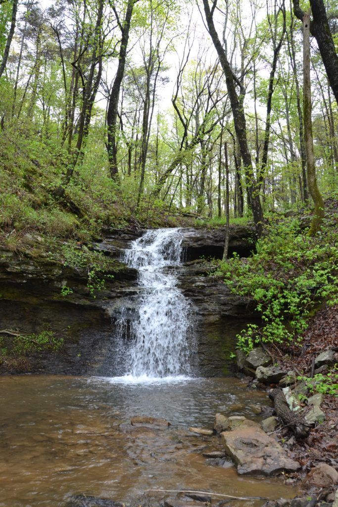
New Trails to Explore at Green Mountain Nature Preserve

Our Land Stewards and trail care volunteers have been busy making improvements and additions at Green Mountain Nature Preserve over the past few months.
Here’s some updates on our progress:
 We’ve added .6 mile Talus Trail, which connects directly to Alum Hollow Trail. Talus meaning “a sloping mass of rock fragments” was a very appropriate name for this trail. It is very rocky and currently dead ends but will eventually continue to the bottom of the hollow.
- Ranger Trail is currently under construction. This 1.2 mile trail is rated Difficult for its rocky terrain and incline. Ranger Trail, which takes its name from the remnants of a Ranger Truck abandoned alongside it, ventures downhill then loops back uphill to Alum Cave and the waterfall. Hikers are welcome to explore. The trail is passable but unfinished so please use caution.
- For his Eagle Project, local Scout Peter McDonald worked with Trail Care Partner Phil Gibson to install signage at trail intersections making navigation a little easier. He also added benches alongside Alum Hollow Trail providing a few spots to take a break and enjoy the scenery.
Green Mountain Nature Preserve opened in 2016 after long-time Land Trust supporters Mr. and Mrs. Robert Kuehlthau donated 122 acres with hopes that others would “travel up to Green Mountain to enjoy the beautiful trees, bluffs, and streams.” This unique property features two primary streams and waterfalls that flow most of the year, ultimately contributing to the Tennessee River. It also holds a prehistoric Native American camp (ca.10,300 – 9,100 BC) as well as Alum Cave, a rock shelter that was used during the Middle Woodland period (1AD – 500AD). This preserve includes a variety of interesting natural and historic features to enjoy and now offers a total of 4.5 miles of trails to explore it all. Trails vary from easy to difficult.

Other trails, not new to the preserve, include:
- Alum Hollow Trail, the main trail in the Green Mountain network, follows the bluff line. This approximately 1 mile trail is easily navigable with the exception of a steep downhill climb at the end leading to the final destination – Alum Falls and around the corner Alum Cave – the Native American Rock shelter described above (pictured below).

- East Plateau Trail & West Plateau Trail are both primarily flat with gentle hills. They begin and end on Alum Hollow Trail.
- Stonefly Trail meanders down the mountain before exiting Land Trust property and connecting to Buzzard Falls Trail, which leads to a nearby subdivision – Oak Bluff on Green Mountain.
Future plans for the preserve include connections to neighboring Madison County Nature Trail as well as Ditto Landing, creating one piece of Huntsville’s Greenway Plan.
Land Trust Trail Care Partner Phil Gibson leads work days at Green Mountain Nature Preserve monthly. If you’re interested in volunteering to help, let us know at 256-534-5263 or questions@landtrustnal.org.
Trailhead: 13800 South Shawdee Road, Huntsville, AL 35803
Directions: Take Carl T Jones Dr SE to Bailey Cove Rd SE. Turn left onto Green Mountain Rd SE which becomes S Shawdee Rd SE. You will see the Land Trust sign on the right after the black fence about two miles down the road.