Land Trust of North Alabama currently has 97 named trails on our public nature preserves, totaling approximately 70 miles. Each one has a unique name some of which we are frequently asked about.
Many trails are named for the area’s natural or historic features. Others honor a land donor, volunteer, or critical partner of the Land Trust. However, certain trail names tell a more unique or unexpected story. No matter which one has peaked your interest or left you wondering, you’ll soon get your answer. In our blog series Trail Names: What’s the Story?, we’ll share a breakdown of all Land Trust trails – one nature preserve at a time – and explain how they got their names.
Blevins Gap Nature Preserve
Trail Names: What’s the Story? Part 2
One of our most popular preserves, Blevins Gap Nature Preserve is a natural oasis just around the corner from busy shopping and residential areas in South Huntsville. The preserve is divided into two sections by Cecil Ashburn Drive. You can find a trail map and more information about Blevins Gap Nature Preserve here.
Blevins Gap South
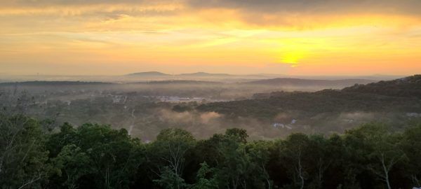
On the South side, you’ll find the Blevins Gap most people are familiar with. The trailhead, directly off of Cecil Ashburn, was recently expanded during road construction and offers spectacular views before you even leave the trailhead. It’s a prime spot to stop and appreciate the sunset! Approximately 8 miles of trails on Blevins Gap South provide moderate to challenging rocky hikes across the northern end of Green Mountain along with plenty of overlooks where you can stop and enjoy a view while you rest.
- Bill & Marion Certain (1.97 miles) – A large portion of the total preserve is actually property of Forever Wild, the State of Alabama’s Land Trust. The Certain Family sold their land to Forever Wild who then partnered with the Land Trust of North Alabama to manage the trails here, expanding the space available for public recreation. This trail is a favorite for many because of the picturesque valley views you’ll find once you reach the top.
- Lowry Trail (0.28 miles) – The Lowry Family donated some of the land that now makes up Blevins Gap Nature Preserve – a common theme here. As you continue reading, you may be surprised to realize it took multiple land donations, lots of generosity, and combined efforts to share this beautiful space with the community. And we’re not done! Have you heard about our River to Gap Vision to create a natural corridor from Blevins Gap all the way to the Tennessee River?
- Smokerise Trail (1.51 miles) – Named due to the proximity to Smokerise Road
- Sugar Tree (1.52 miles) – Named in recognition of its proximity to Sugar Tree Road

- Varnedoe Trail (1.79 miles) – Named to honor long-time supporters of the Land Trust, avid cavers, and true experts on everything Green Mountain, Bill and Louise Varnedoe.
- West Bluff Trail (0.80 miles) – This trail curves along the west side (bluff) of Green Mountain offering valley views.
Blevins Gap North
Blevins Gap North, on the other side of Cecil Ashburn, is accessed from a trailhead located behind Southeast Church of the Nazarene (just uphill from Mellow Mushroom and within sight of the Valley Bend shopping center). These trails (approximately 4.5 miles) offer a little quieter option with a rain-dependent mountainside creek and more rocky hikes to get your cardio fix. Did you know that this area is actually Huntsville Mountain? Cecil Ashburn cuts between Huntsville Mountain and Green Mountain.
- Bailey Cove Trail (0.26 miles) – If you are familiar with South Huntsville, you know that Bailey Cove refers to the surrounding area. Well the name “Bailey Cove” originally referred to this exact geographical area. Welcome to Bailey Cove!
- Chittamwood Trail (0.23 miles) – There is a significant amount of Chittamwood found around this trail. Chittamwood, also known as American Smoketree, is a native tree species that occurs on limestone outcrops and is extremely drought tolerant once established. The wood is a bright golden color, hard and heavy. Chittamwood, especially the burl, is one of the rare exotic woods in North America.

- Fanning Trail (2.04 miles) – This one is named for Thomas Fanning, who donated the property to the Land Trust. This was one of the first properties the Land Trust received in 1988.
- Jones Valley Loop Trail (0.72 miles) – It is in fact located in Jones Valley but this trails name honors The Jones Family, donors of the property.
 Scout Trail (0.37 miles) – Our local scouts are a valuable resource when we need help to create new trails. They contributed lots of volunteer time to establish trails in this area.
- Stevenson Trail (0.52 miles) – Ed Stevenson, as President of Stevenson Development Corporation, donated this 16.9-acre piece of Huntsville Mountain to the Land Trust of North Alabama on December 22, 1988, making it the very first property the Land Trust acquired after its founding. So as you walk this trail, we invite you to stop, enjoy the forest around you, and appreciate the beginning of a fantastic community-led conservation story.

- Walsingham Trail (0.45 miles) – Named for it’s proximity of Walsingham Road.
Stay tuned. More trail names to come.


