Rainbow Mountain: What’s the Story?

Land Trust of North Alabama currently has 97 named trails on our public nature preserves, totaling approximately 70 miles. Each one has a unique name some of which we are frequently asked about.
Many trails are named for the area’s natural or historic features. Others honor a land donor, volunteer, or critical partner of the Land Trust. However, certain trail names tell a more unique or unexpected story. No matter which one has peaked your interest or left you wondering, you’ll soon get your answer. In our blog series Trail Names: What’s the Story?, we’ll share a breakdown of all Land Trust trails – one nature preserve at a time – and explain how they got their names.
Rainbow Mountain Nature Preserve
Trail Names: What’s the Story? Part 6
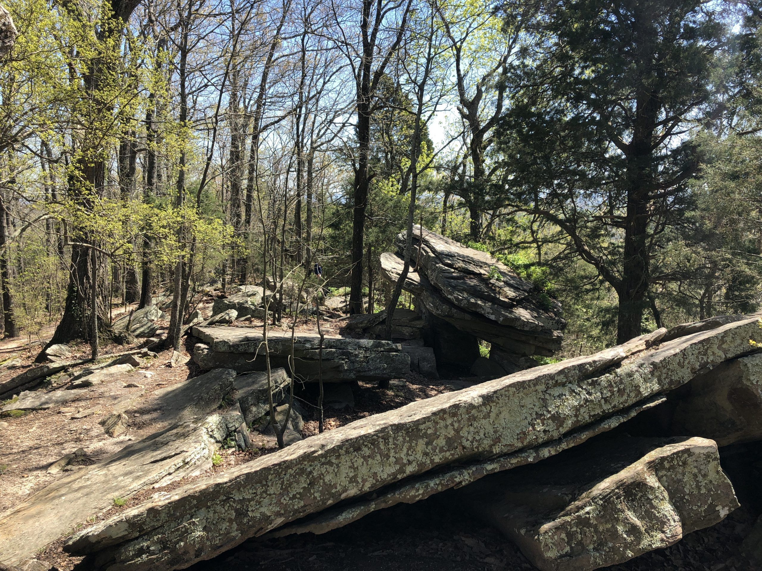
Rainbow Mountain Nature Preserve is a hidden treasure tucked within a residential area off of Hughes Road. The trailhead located at the top of the mountain offers a pavilion (where you can stop for a picnic), two parking areas (one next to the pavilion and another up the hill next to the water tank), and a playground (located just behind the pavilion). The highlight of this property is the interesting rock formations. It’s rocky terrain overall but the large boulders field atop the mountain makes for a natural playground. Trails wind beside and between the rock walls. Visitors can expect relatively easy hikes on trails close to the trailhead but if you decide to take a turn downhill be prepared for a more challenging route. The climb downhill is steep and uneven and always remember you’ll have to return the same distance. After recent rainfall, you’ll find a small waterfall and perfect spot for a rest at the very bottom where Rainbow Mountain Loop intersects with Spring Trail. Despite being completely surrounded by the City of Madison, you’ll feel a little more isolated. It’s a perfect outdoor escape, close to home. You can find a trail map and more information about Rainbow Mountain Nature Preserve here.

- Balance Rock Trail (0.27 miles) – This one should be obvious to anyone familiar with Rainbow Mountain because Balance Rock is the featured destination along the trails. Balance Rock is exactly what it sounds like a rock that appears to be precariously balanced atop another. This fascinating feature was created when softer layers of rock eroded below and around a denser rock leaving behind a spectacular natural sculpture.

- Berry Trail (0.08 miles) – Nat Berry was a volunteer with the Land Trust who was instrumental in the development of trails on Rainbow Mountain.
- High Pass Trail (0.11 miles) – This little trail crosses the highest point of the nature preserve.
- Jake Trail Loop (0.07 miles) – Aside from his obvious love of the outdoors, Nat Berry, the volunteer we mentioned earlier, also loved his dogs. So he named this trail after his beloved dog Jake. You may still spot old trail diamonds periodically that feature a little illustration of a dog.

- Ja Moo Ko Loop Trail (0.80 miles) – This is one of the trails that we get lots of questions about because it’s such an unusual name. Well, it turns out Nat Berry had more than one dog and he didn’t want to slight the other. The name is a creative combination of three dogs’ names actually: Jake, Moon, and Kodiak. The first two were Nat’s dogs and the third Kodiak belonged to fellow volunteer Marcia Hoppers.
- Rainbow Loop Trail (1.53 miles) – Well, no has ever asked. But just to clarify, Rainbow Loop Trail was named for the mountain and it’s a loop. But a fun fact you may not be aware of is where the name Rainbow Mountain actually comes from. An early property owner in the area was Elisha Rainbolt and locals began to use his name to reference the mountain. However, over time this name for the site was mistakenly replaced by the current day “Rainbow” Mountain. From this 1.53-mile trail you can access to the entire Rainbow Mountain trail system. “Loop” makes it sound like it might be a breezy walk but that’s not necessarily the case. The trail eventually climbs down the rocky mountain side with with an approximately 350 foot elevation change. The only way back to the trailhead, where you began, is to climb right back up. So come prepared for a hike, not a stroll.

- Spring Trail (0.20 miles) – Alongside the trail, you’ll find a spring that trickles downhill through the rocks, especially after rain.

- Stoneridge Trail (0.07 miles) – This trail begins alongside the pavilion and parking area and leads directly to Stoneridge Park. This City of Madison park features a great playground. The trail continues a little beyond the playground. A quick nature walk, playground time, and a picnic at the pavilion sounds like a perfect outing with kids.

- Wild Trail (0.34 miles) – This trail was named in jest for its personality as a somewhat difficult environment.

Stay tuned. More trail names to come.